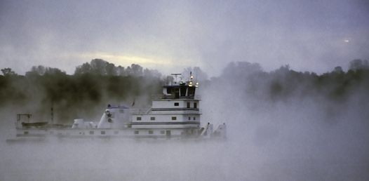
It’s 4 a.m. when we wake to a nightmarish sound of grinding metal and straining diesel engines. Suddenly, we’re blinded by a powerful searchlight. Anchored 200 yards off the mighty Mississippi, we’re tucked into the mouth of Little River Diversion Channel, 130 miles south of St. Louis. The huge towboat pushing a long, wide cluster of barges upriver must have caught a log in its props, and its powerful, 5,000-horsepower engines are grinding it up like a toothpick. The river here takes a sharp, 90-degree turn, and the captain is keeping his eye on the shoreline with his searchlight. We’re reminded of what we heard earlier from an experienced Looper, “Going down these rivers is no vacation. It’s a real adventure.”
We’d left Peoria, Ill. (MM165), the week before after waiting for the remnants of a hurricane to pass. Following a 100-mile run down the Illinois River, we drop anchor off uninhabited Big Blue Island (MM 59.5), where we find a sandy beach to walk our dog. Knowing that barge traffic would be chugging by during the night, we deploy a stern anchor to prevent swinging anywhere near the channel.
The next day, we stop for fuel in Grafton, Ill. (MM 0), where the Illinois River meets the mighty Mississippi. Grafton Harbor Marina is a modern facility and a popular place to regroup before heading down the Mississippi to St. Louis and beyond. With our fuel tanks topped off, we enter the Mississippi at MM 218 and stop for the night in Alton, Ill. (MM 202.5), 25 miles north of the Gateway City. The Alton Marina is close to the historic downtown area, which features attractive Federal-style homes and convenient shops and restaurants. Surprisingly, there are no marinas in St. Louis proper, and the next facility with fuel is Hoppies Marina at MM 158.5.
Braving the Barges
Traveling these 200 miles down the Mississippi to the Ohio River requires planning and caution. There are few facilities for boaters and heavy commercial traffic. A standard barge measures 195 by 35 feet, and each can hold the equivalent of 50 to 60 tractor-trailer truckloads. Many tows are three barges wide and five long, but some are as large as six wide and seven long. Do the math, and that adds up to over 2,000 truckloads. These massive loads are being pushed by monstrous towboats, the largest of which are 200 feet long and powered with up to 11,000-horsepower diesel engines.
Obviously these rigs have the right-of-way on the rivers, so we’re extremely cautious as we approach them, especially where the river bends. Although the Mississippi is big and wide, these tows need all the room they can get.

Fog on the Mississippi
When overtaking or meeting a tow, communication with the captain is essential. To make sure we don’t get confused about the “whistle” rules of navigation, we post a note at our helm:
“On the one“ = pass him on our port side
“One the two“ = pass him our starboard side
As we get near, we call the towboat on VHF channel 13 and identify ourselves as a pleasure boat traveling downbound at a specific mile marker. (In the cruising guides, “RDB” refers to the river’s right descending bank and “LDB” refers to the left descending bank.) We then ask the captain how he would like us to pass him. In nearly every case, the captains are friendly and courteous and wish us a safe trip down the river. We’re often fondly referred to as an “RV.”
A few miles downriver from Alton, the Missouri River meets the Mississippi, not far from where Lewis and Clark began their expedition. We follow the signs to the Chain of Rocks Canal, a narrow 10-mile cut. It’s a busy channel with tows coming and going, and some are just sitting to one side, making things difficult as we try to pass before meeting oncoming traffic. Exiting the lock at the southern end of the canal, we’re soon passing the famous Gateway Arch. It’s an exciting sight, and we make a couple of U-turns to take photos. Unfortunately, there’s no place along the city’s waterfront to tie up, so the best way for Loopers to visit St. Louis is to rent a car in Alton.
Barge traffic seems to be intensifying, and we’re more aware of “diversion dikes” along the riverbanks. Like fingers reaching out into the river, these rows of diagonal structures, also called wingdams, divert the fast-flowing water into the middle of the river to prevent silting. Their downriver sides can provide a place to anchor overnight, as they create pockets of deep water free of the river’s current.
Happy at Hoppies
The sight of Hoppies in Kimmswick is a welcome one. With nothing more than a few barges and a fuel dock moored to the riverbank, the Hopkins family has been providing transient boaters with a safe haven for over 50 years. Fern Hopkins welcomes us as we tie up, and we enjoy our afternoon chat. As always, she provides valuable information about the current conditions on the river. Since the last time we were here, the Army Corps. of Engineers has built diversion dikes near her marina, and she’s not at all happy with the resulting silting around her barges. Nonetheless, we have plenty of water to tie up to the outside, and because there’s little or no fuel for at least the next 200 miles, we fill our tanks.
After our rude awakening in Little River Diversion Channel, 110 miles south of Hoppies, we leave at first light. We run 50 miles to the Ohio River and the town of Cairo, Ill., which unfortunately has no facilities for recreational boats. Past Cairo, we transit two locks and run 40 miles to Paducah, Ky., where years ago we tied up to a series of barges known as the Big E marina. Sadly, this convenient stopover was washed away and never replaced.
From Paducah we have a choice of running 25 miles on the Tennessee River to Kentucky Lake or 45 miles on Cumberland River to Lake Barkley. The longer route takes less time because it avoids typically long delays at Kentucky Lock.
Taking the scenic Cumberland River, we arrive at the Green Turtle Bay Resort in Grand Rivers, Ky., just before dark. It’s been a long day, and we’re glad to be off the river. The amenities of this full-service marina seem like pure luxury, and we decide to take a break and rent a small condo and a car for few days while we have the boatyard do some routine maintenance. We drive to Paducah for a tour of the Center for Maritime Education, where towboat captains are trained. Sitting in the simulated ship’s bridge, we’re fascinated to see what the captain sees as he heads up and down the rivers.
From Grand Rivers we’re less than 100 miles from Nashville, so we take a road trip for a night at the Grand Old Opry. We’ve been listening to more country music as we’ve been traveling down the rivers, so it’s a real treat for us to see Vince Gill and the Nitty Gritty Dirt Band. Indeed, our night at the Grand Old Opry was one of the highlights of our one-year trip.
The Turning Point
Our boat is now ready with a fresh coat of bottom paint, an oil change and new fuel filters, and we set out to explore beautiful Kentucky Lake and the Land Between The Lakes. This is a turning point for our trip, as the industrial areas and commercial traffic give way to a more scenic, relaxed style of cruising. Alternating between quiet anchorages and pleasant marinas, we travel 200 miles along Kentucky Lake and the Tennessee River to arrive at Pickwick Lake, eight miles from the Tenn-Tom Waterway. We now have 450 miles and 12 locks to go before reaching our final destination of Mobile, Ala.
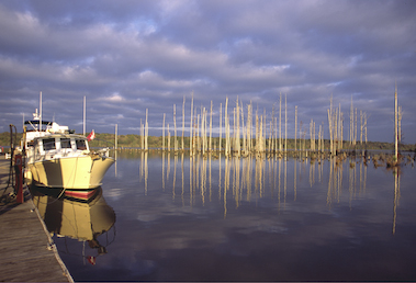
These miles are perhaps the most memorable of our river adventure, as we are introduced to America’s finest southern hospitality. Experiencing major delays at the locks below Pickwick, we arrive late at night at Midway Marina (MM 394), just 60 miles from where we started. The dockmaster is waiting for us and patiently talks us through the narrow, unlit channel. After we check in, he warns us about the 10 foot alligator that’s been hanging around the marina. Welcome to Mississippi. The next day, we meet a family living aboard their 60-foot houseboat, and they take us for a tour of Tupelo to see Elvis Presley’s birthplace. That night, we attend a school play performance of Mark Twain’s “The Adventures of Tom Sawyer.”

Midway Marina
In Columbus, Miss., we stay at the friendly Columbus Marina (MM 335), which lets us use their pickup truck to go to town. While doing some early Christmas shopping, we tell one of the shopkeepers that we’re traveling down the rivers, and she gives us her personal cellphone number saying, “Ya’ll just call me if you need anything.” Unbelievable.
After anchoring overnight at Sumter Landing (MM 270), we arrive in Demopolis, Ala. (MM213), a major gathering place for Loopers. Friends we haven’t seen since Chicago are here to greet us, and we enjoy comparing notes of our river odysseys. Stormy weather keeps us tied up for days, so we take advantage of the town’s charm, visiting historic antebellum mansions and indulging in authentic, southern style cooking.
We break up the next 217 miles with a stop at Bobby’s Fish Camp (MM 118.9), a simple, rustic facility with a couple hundred feet of dock space and a fuel dock. Bobby passed away in 2010, but his daughter continues to run it. The little restaurant, which is also a museum of local artifacts, is open Thursdays, Fridays and Saturdays and is known along the waterway for its delicious fried catfish.
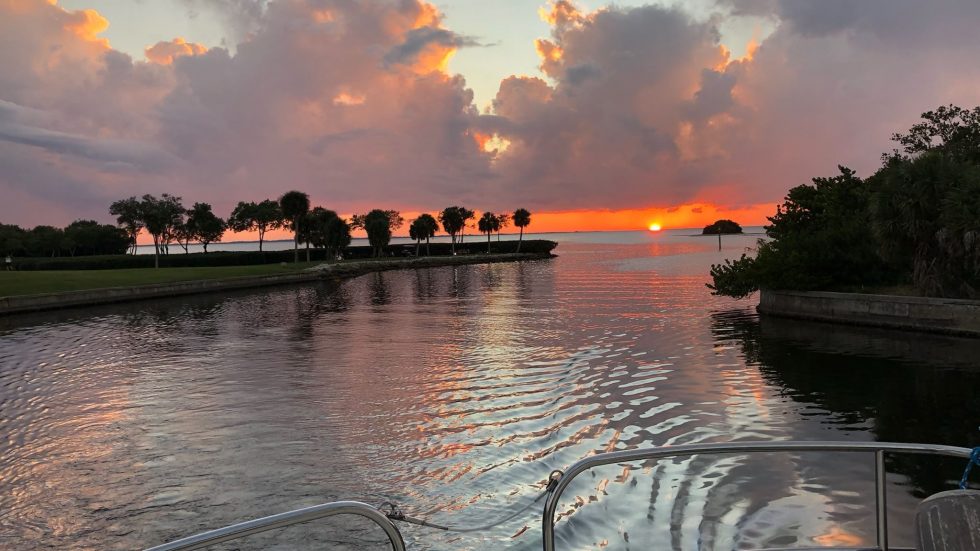
Our long journey circling the eastern half of North America ends in Fairhope, Ala., just south of Mobile. This is a wonderfully friendly, attractive town, and we spend days here regrouping and reflecting on our adventure, especially our 1,200-mile run down these mighty rivers.
We honestly feel we could not have experienced so much of America’s rich heritage — its raw beauty, vigorous commerce, charming towns and generous, gracious people — if we had traveled any way other than by boat. Doing the Great Loop was a journey of a lifetime, and it’s very much accessible to those with a boat and an adventurous spirit.


