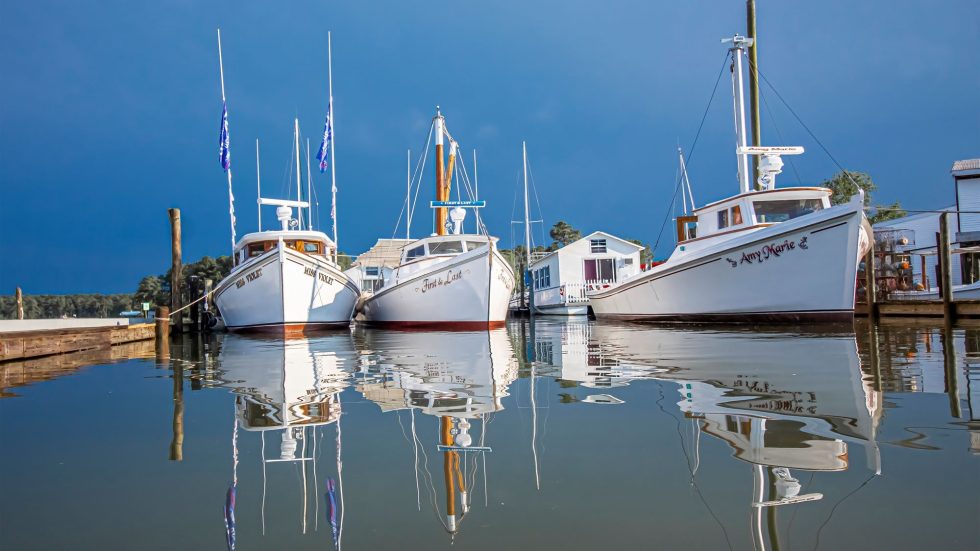
The following summary is meant to highlight some stops and resources to aid in the navigation of the 5 waterways that make up the inland portion of The Great Loop. Along with a brief summary of each waterway, suggested marina and fuel stops are listed—including some potential sights along the way. Keep in mind that the marina and fuel stops are simply suggestions, and we encourage you to use the complete details in each section of this guide to aid in your planning—as daily miles traveled and fuel consumption vary greatly from one vessel to the next.
Illinois River
Summary:
Running the width of the state bearing its name, the Illinois Waterway is a system of channels with its beginnings just off Lake Michigan. It consists of eight locks and ends 336 miles to the Southwest when it joins with the Mississippi River in Grafton, Ill.
Navigation Notes:
Travelers from Lake Michigan can enter the Illinois Waterway at either Chicago Harbor via the Chicago Lock to the Chicago Sanitary & Ship Canal, or at Calumet Harbor via the Thomas J. O’Brien Lock to the Cal-Sag Channel. Vertical clearance on the system is restricted to 17 feet on the Sanitary & Ship Canal and 19 feet on the Cal-Sag.
Potential Marina and Fuel Stops:
- Heritage Harbor, MM 242.4 RDB
- EastPort Marina, MM 164.5 LDB
- Logsdon Tug Service, MM 88 LDB
- Grafton Harbor, MM 0.0 LDB
Resources:
- Illinois River Lock Mile Markers
- Bridge Clearances: minimum overall clearance on the system is 80 feet.
Sights:
This is one of the most esoteric cruising experiences in the entire U.S., as the Illinois River makes its way directly through downtown—passing by some of the most influential architectural structures of the 20th Century. Some notable wonders to keep an eye out for:
- The Wrigley Building – At the juxtaposition of Michigan Avenue and The Chicago River, this iconic structure is the preeminent edifice of architecture and business in the 20th century. Completed in 1924, the building boasts a clock that faces in all directions and is over 5 meters in diameter. If you are lucky enough to cruise the river at night, too, the building is illuminated with floodlights.
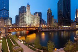
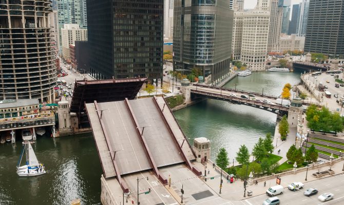
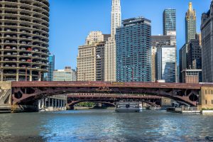
Chicago Drawbridges – Running perpendicular to the Wrigley Building is the beginning of a series of historic drawbridges along the Chicago River, including the Desable Bridge (Michigan Avenue), State Street Bridge, Dearborn Street Bridge, LaSalle Street Bridge, Wells Street Bridge and Madison Street Bridge. Many of these bridges have a history dating back to the late 1800s and are a crucial part of downtown traffic today.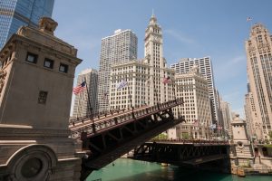
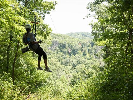
- Grafton Winery and Outdoor Recreation – Grafton Harbor Marina boasts its very own winery, with sampling available at the gift shop or a full wine bar experience just up the hill from the marina. For the adventurous spirit, take the sky tour lift to the top of the bluffs and book a zip-line tour along the forested ridge.
Mississippi River
Summary:
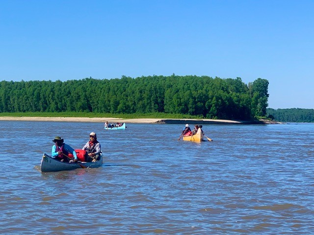
Being the third largest river system in the world, this waterway has played a critical role in our country’s history, commerce, agriculture, art, literature and recreation. As America’s original highway, countless vessels have made the journey, and cruising the Mississippi River today is an immediate throwback to the days of steamboats navigating from one town to the next. In addition to transporting goods, services and people, migrating birds—including the American Bald Eagle—have made it the largest and most heavily traveled flyway in North America, as well.
Navigation Notes:
The Mississippi River offers two distinct routes as a part of America’s Great Loop. The first route—and most frequented—is cruising from the confluence of the Illinois River to Cairo, Ill. From there, you hop onto the Ohio River as a transition to the southward bound Tennessee and Tenn-Tom waterways. The second route—and less frequented—is to continue south on the Mississippi River past Memphis, Tenn., to New Orleans. As for adventure, we would not recommend one route over the other, but they do provide two very different cruising experiences—with the lower Mississippi being a more remote stretch.
CAUTION: Just north of St. Louis is the chain of rocks. This is not a navigable section of the waterway. All mariners must use the chain of rocks canal (entrance is signed) at MM 194.1 LBD to bypass the rock dam and rapids across the old main channel, which has a 4-foot drop about 300 feet below a castle or rook-like water intake for the city of St. Louis.
Potential Marina and Fuel Stops (Upper Mississippi Route):
- The Alton Marina, MM 202.9 LDB
- Hoppie’s Marina, MM 158.5 RDB
- Evansville Marina (Kaskaskia River), MM 10.5 LDB
Potential Marina and Fuel Stops (Lower Mississippi Route):
- Mud Island – Memphis Yacht Club, MM 735.8 LDB (Fuel)
- Tunica River Park Courtesy Dock, MM 699 LDB
- Greenville Yacht Club, MM 537.2 LDB (Fuel)
- Weber Marine, MM 167.0 LDB
- Cypress Cove Marina, MM 10.5; TIGER PASS (Fuel)
Resources:
Sights (Upper Mississippi):
The expansive and winding nature of the Mississippi River becomes immediately apparent as you enter this section of waterway. Check out these sights, including some great overnight stops in some historic river towns.
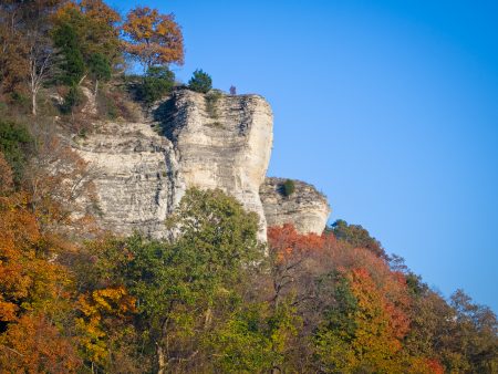
- Bluffs between Grafton and Alton – The towering bluffs between these two towns offer a grand backdrop to the great river road and this wide section of waterway. A slower river flow at this pool of the Mississippi allows for you to kick back and put your feet up at the helm to take it all in, too.
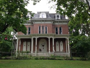
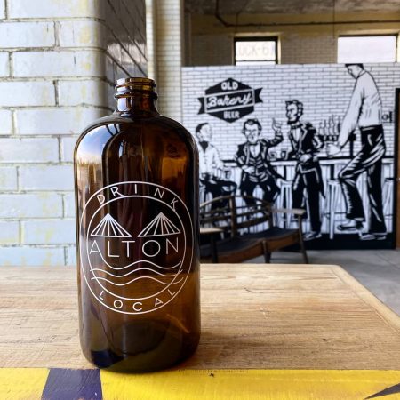
- Alton Tours / Restaurants – quite often coined as having some of the most haunted mansions in America, this quaint “Steamboat Town” offers guided ghost tours of some of the homes—including the infamous McPike Mansion. If it is food you are after, a short trek up through town from the marina brings you to the old post office that has been converted to a unique brunch café—along with live evening music. To quench your thirst, check out The Old Bakery Brewery just a few more blocks South—with a variety of original brews and artisan burgers.
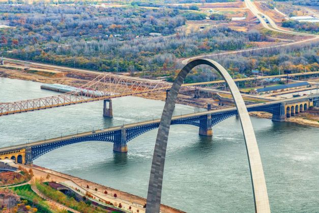
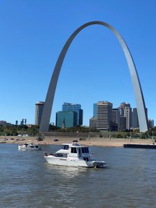
- St. Louis Arch – An iconic structure that was designed and constructed as a symbol of the Gateway to the West. St. Louis has a very special place in river history and was once the 3rd largest port in America. Whether cruising through during the day or at night, it is a sight to behold. For those that want to enjoy the city a bit more—on land—we recommend staying docked at Alton and either renting a car or taking an Uber into the city.
- Hoppie’s Marina – Quimby’s Cruising Guide and Hoppie’s Marina are nearly synonymous. And, for a number of decades this marina has assisted boaters with fuel from their fuel barge—along with being a wealth of information on Mississippi River navigation in general.
- Side Trip – Kaskaskia River overnight anchorage and the Water Street Bar & Grill
Sights (Lower Mississippi):
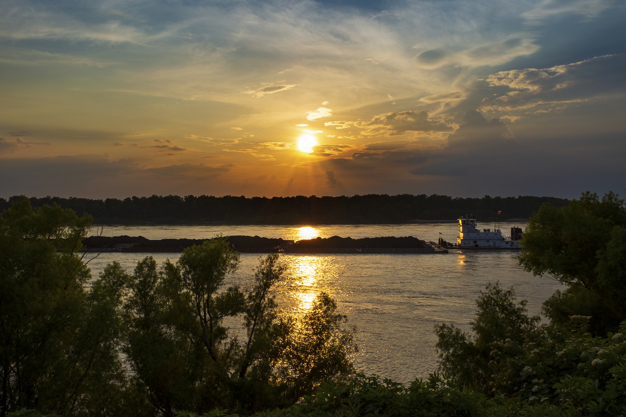
- Barges in tow – from steamboats to modern towboats, these vessels are true workboats and have had a huge impact on commerce. To this day, many of these barge lines are still family owned—and include namesakes for their vessels. A fun activity is to look back at the history of each boat based on the boat name and company stack logo. Check out the inland river record (www.waterwaysjournal.net) for a full listing of vessels—searchable by name and stack logo.
- Buck Island (Helena, Ark.) – For a fun adventure, check out the Quapaw Canoe Company’s tours of the island that include canoeing, beach camping and hiking.
Ohio River
Summary:
The Ohio River portion of The Great Loop provides a short—but memorable—section of your journey. Acting as a major waterway to connect the steel and coal business to the Mississippi River—and thus aiding in the overall infrastructure of America—the Ohio River plays a crucial role in industry. The early success of the steamboats and their impact on the Ohio valley eventually led to the first Waterways Improvement Act in 1824 and is responsible for the infrastructure in place that secures the proper resources to maintain navigable waterways throughout the United States.
Navigation Notes:
Coming up in Cairo, Ill. just after the Cairo Mississippi River Bridge you will loop north to enter the Ohio River—with Fort Defiance Park on your left. If you go under a subsequent bridge shortly after—the Cairo Ohio River Bridge—you will know that you are proceeding in the correct direction. From there, it is just a short 47 miles to the Tennessee River.
Potential Marina and Fuel Stops:
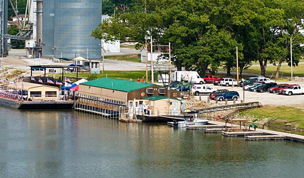
Paducah Transient Dock, MM 935.0
![]()
Resources:
Ohio River Digital Guide – www.ohioriverrecreationtrail.org/digital-guide
Paducah CVB – www.paducah.travel
Sights:
If you want to experience a town that is intrinsic to life with the river, there is no better place than Paducah, Ky. Take advantage of their transient dock as an overnight or multi-night stay and check out some of the following sights.
- Murals – Paducah is well known for its many flood wall murals. Artists are commissioned from time to time to have a series of murals on rotation that quite often depict river life throughout history.
- Quilt Museum – Paducah is home to the National Quilt Museum—created to celebrate the work of modern quilters and bring the art of quilting to new audiences.
- River Discovery Center – Visitors have a chance to captain a towboat, speedboat or Coast Guard buoy tender through various scenarios in a pilothouse simulator.
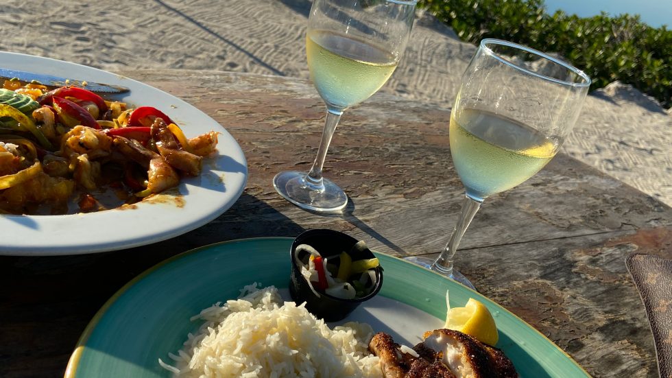
- Good Eats – Paducah is no stranger to great food. Check out these recommendations that are just a short walk from the transient dock: Kirchhoff’s Bakery, Doe’s, Broussard’s Cajun Cuisine.
Tennessee River
Summary:
The Tennessee River is formed at Knoxville, Tenn., by the junction of the Holston and French rivers, flowing south and southwest to its confluence with the Ohio River at Paducah, Ky. It flows through portions of four states: Tennessee, Alabama, Mississippi and Kentucky. Rugged mountains and green forests dominate the eastern portion of the valley; rolling hills, open fields and woodlands lie to the west.
Navigation Notes:
The mouth of the Tennessee River is at MM 934 of the Ohio just outside of Paducah, Ky. Head southbound until you reach Kentucky Lock & Dam at MM 22.4. This portion of the Great Loop has more of a lake cruising feel, as the series of locks create a total of nine lakes on the waterway. Kentucky Lake can be a great spot to stay for a few days and enjoy some good old fashion recreational boating—including skiing, tubing and quiet anchorages and swimming coves.

Potential Marina and Fuel Stops:
- Kentucky Dam Marina, MM 23.0 LBD
- Pebble Isle Marina, MM 96.5 RDB
- Birdsong Resort, Marina & Lakeside RV Campground, MM 103.5 LDB
- Pickwick Landing State Park, MM 207.6 LDB
Resources:
Sights:
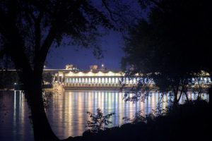
- A Dam Good Tour, Wilson Dam – in cooperation with the Tennessee Valley Authority, the US Army Corps of Engineers offers the public free, guided tours of Wilson Lock and Dam. The tours are approximately 90 minutes in length.
- Birdsong Pearl Museum – Pearls on the river! This museum is a part of the Birdsong Resort and Marina and showcases different types of freshwater river pearls farmed in this area. It is home to the only freshwater pearl culturing farm in North America.

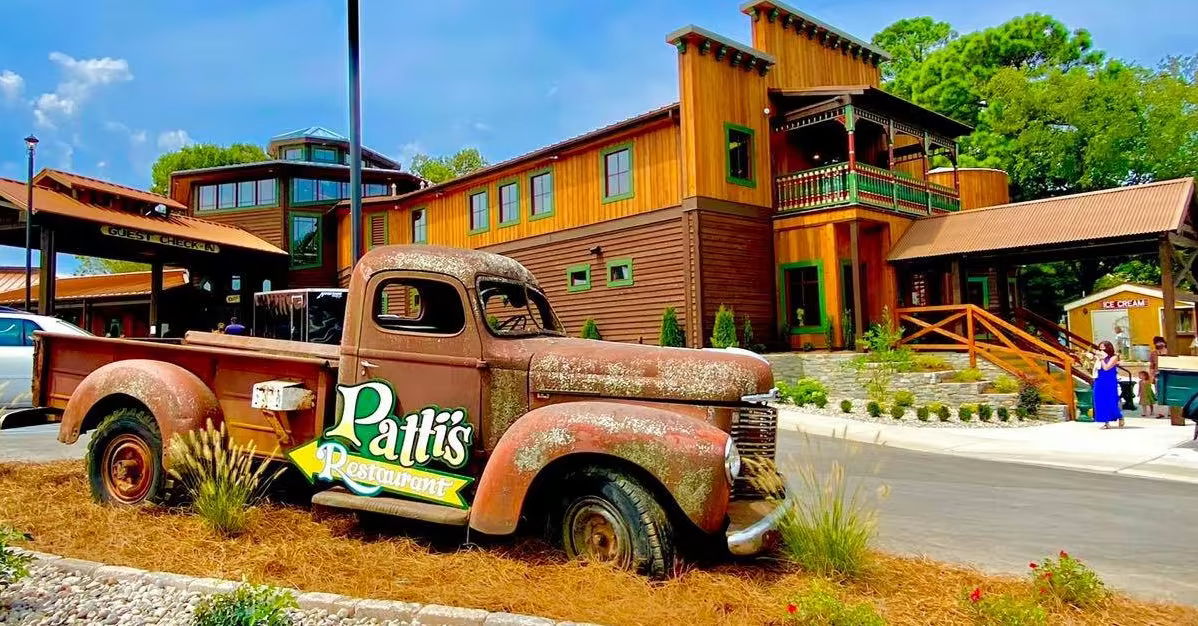
- Grand Rivers, Ky. – this quaint little town has a lot to offer—including antique shops, seasonal festivals and the world-famous Patti’s 1888 Settlement Restaurant.
Tenn-Tom Waterway
Summary:
Construction on the Tenn-Tom project began in 1972 and would go on to become the largest civil works project ever undertaken by the Corps of Engineers, which spent $2 billion to make it happen. By connecting the Tennessee River in Mississippi and the Black Warrior River in Alabama, it provided a direct water route from the Tennessee River to the Gulf Intracoastal Waterway—and is a crucial waterway when attempting the Great Loop.
Navigation Notes:
Hop on the Tenn-Tom waterway at MM 215 of the Tennessee River—marked by a Yellow Creek Light & Daymark (Mile 215.3). This cruising section entails a number of locks and dams. Reference the below mile markers and make sure you plan ahead with each lock—either via radio or phone.
Potential Marina and Fuel Stops:
- Grand Harbor Marina, MM 449.7 RDB
- Aqua Yacht Harbor, MM 448.7 RDB
- Bay Springs Marina, MM 413.0 RDB
- Columbus Marina, MM 334.7 LDB
- Turner Marine Supply, MM MOBILE BAY/DOG RIVER
Resources:
Sights:
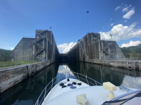
- Locks and Dams – the Tenn-Tom gives you an inside look at the modern infrastructure put in place to create such a system. To overcome a 341-foot difference in water levels, 10 locks were constructed. Locking through is part of the experience—with the Jamie Whitten Lock being the first one on your journey.
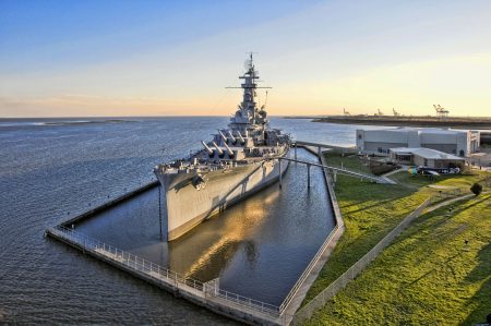
- USS Alabama Battleship in Mobile Bay – The USS Alabama Battleship Memorial Park is home to the iconic World War II naval battleship as well as the USS Drum Submarine.
For a full listing of marinas, fuel stops and lock and dam information, order the entire guide here