There are several aspects of this river that affect recreational boaters. Most unique are wing dams, which are submerged rock piles placed perpendicular to shore. These can cause great damage to boats that run over them in low water. Most, but not all, are marked on the Corps of Engineers’ navigation charts. These also show other hazards and features important to boaters.
The constant current is generally not too fast but relentlessly powerful. Landings should be made going upstream. Current is also a factor when beaching a boat on an island or sandbar. The approach should be made perpendicular to shore to avoid wing dams.
Anchoring should be done out of the channel and preferably in a protected chute or slough. Those that flow through from top and bottom usually have the deepest water.
There are a great number of town docks available along the Upper Mississippi and approximately 100 marinas to the last one just below St. Louis.
The charts also show stump fields to avoid. Described as “barbered forests,” they are common in the wide and expansive pools above locks and dams.
Finally, understanding towboat operation is essential. A 15-barge tow is a huge floating steel platform that creates significant turbulence and wakes and needs at least a quarter-mile to stop. Boaters should never cross closely in front of them and give them as wide a berth as possible. In twisting and narrow channels, communicate with them on VHF Channel 13 to avoid getting into a dangerous situation.
The Upper Mississippi is a mix of commerce, a wide variety of recreational opportunities and an endless source of wonderment and fascination.
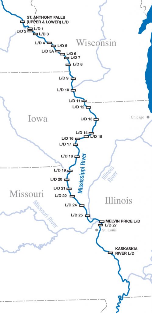
Mississippi River Lock Mile Markers
Lower St. Anthony Falls Lock: 853.3
Lock & Dam 1: 847.6
Lock & Dam 2: 815.2
Lock & Dam 3: 796.9
Lock & Dam 4: 752.8
Whitman Lock & Dam 5: 738.1
Lock & Dam 5a: 728.5
Lock & Dam 6: 714.1
Lock & Dam 7: 702.5