GPS/Chart Plotters
If you own a smartphone, it’s far cheaper to download the Navionics Boating App (free) or Navionics Boating USA App ($9.99) than it is to buy a chart plotter. These apps offer cartography containing thousands of lakes, plus many features the big plotters have, including route planning, tracking and bathymetric mapping. And since most lakes don’t have SAR units monitoring VHF channel 16, your phone may be a better tool in an emergency anyway!
Garmin makes a watch called the quatix 3 that houses a built-in GPS and GLONASS antenna. It records a GPS track log, creating a “bread crumb trail” as you move, and also allows you to mark locations, such as a course checkpoint or a dock, mooring or other point of interest. With quatix 3, you can create and follow courses, mark up to 1,000 locations, and store up to 10,000 track points and navigate to them. Suggested retail is $600.
Depth Sounders
Inland boaters often find a depth sounder more crucial to their navigating safety than a chartplotter, as underwater snags, shoals and the like can spoil a day quickly. It also helps to know the depth when preparing to anchor.
Depth sounders can be anything from a simple digital readout starting at about $100 to a four-color display with forward and side-scanning abilities. They come in different sizes to accommodate varying dashboard spaces. Mount your unit on a bracket or flush-mount it directly into the dash itself.
Most manufacturers offers both types of units, including Furuno, Garmin, Humminbird, Interphase, Lowrance, Norcross, Raymarine, Si-Tex, Simrad and Standard Horizon.
Personal Locator Beacons
I’d venture to say that Heartland boaters rarely need Emergency Position Indicating Radio Beacons (EPIRBs). But I’ve found Personal Locator beacons (PLBs) to be very handy. Some dedicated models send out a distress signal to search and rescue outlets via satellite — but that’s all they do.
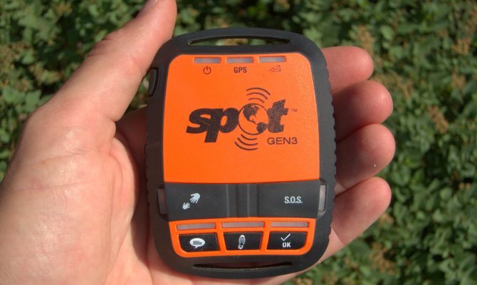
Others, like SPOT, do that as well as provide you with satellite texting ability. I often send a signal to my family members when I’m offshore or out in the wilderness that comes up on their computers with a satellite map image of my location. That’s also very handy.
The best thing about these units, though, is that you don’t need to be within cellphone range. In an emergency, the search and rescue outlet will immediately contact the nearest assistance to your location and speed them to you. It could mean the difference between help arriving within a short time, or never.
VHF Radios
I’m amazed at how many small boats leave the dock without a simple VHF radio. Most models today incorporate Digital Selective Calling (DSC), which, once you register your Maritime Mobile Service Identity (MMSI), can automatically send a distress call with all the pertinent information about you and your vessel, all at the push of a single button. But that’s not all. You can also communicate with other vessels in secret. Say you’re fishing and find a super-productive spot that you’d like to share with one or two of your friends but not the whole world. You can do just that with DSC. Only your designated recipients will get the message, with the other anglers none the wiser!
Mini MFDs
Those who want to “have it all” but not spend a fortune can avail themselves of a new mini Multi-Function Display (MFD). These afford you all the navigation abilities of ocean-going ships but in a box with a 4- to 6-inch screen. Thanks to the incredible features within these units, you can see the bottom clearly all around you, navigate pre-planned routes on a real chart, tell when you’re off course, monitor all your boat’s engine and electrical systems, see what other larger vessels are transiting the area (along with their name, course, speed, destination and last port of call), guide yourself back to a man overboard, watch closed-circuit video from your GoPro, control your stereo and lots more. Compared to the larger units, these cost a mere pittance, and yet they accomplish most all the same functions.
Author: Dean Travis Clarke is a regular contributor to HeartLand Boating


