Imagine if it were possible to cook up in short order what Mother Nature took millions of years to accomplish. Back in the 1920s, one man said it was possible by diverting rivers to intentionally flood low-lying land north of Lake Superior. If the project were feasible — and since then some observers have agreed that it is — there would be enormous benefits for the millions of people who live around the Great Lakes.
Canadian engineer and explorer Lorne Campbell hatched this seemingly unbelievable scheme 100 years ago. According to him, the basin for a sixth Great Lake lies almost ready-made. The trick could be accomplished by building two dams to convert the natural basin of the Albany River into a new lake two and a half times the size of Lake Ontario and building a canal less than two miles long to carry water from this lake into Lake Nipigon, through the Nipigon River and into Lake Superior.
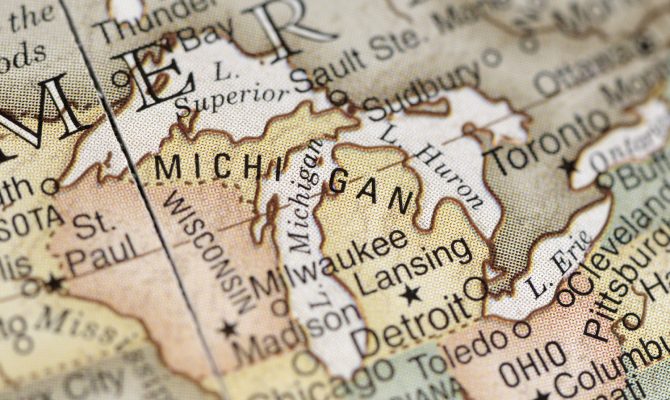
Campbell’s plan focused on the Canadian Shield, one of the most notable geological features of North America. Named for its fancied resemblance to an inverted shield, this rocky plateau extends a thousand miles to the east and northwest from the shores of Hudson Bay, and more than half of that distance toward the south and southwest. In all, the formation covers almost one fourth of the continental surface of North America.
Campbell looked specifically at the area surrounding the Albany River. Sometimes referred to as “the St. Lawrence of the North,” the Albany cuts through the shield, carrying an enormous volume of water into James Bay, through the Hudson Straits and out to the North Atlantic. The Albany basin lies between two heights of land that run east and west. These natural divides converge at the eastern and western ends; the Albany River is the neck of the bottle through which waters make egress.
Managing Lake Levels
Campbell’s recommended first step in creating a sixth Great Lake was stopping the Albany River’s flow by building a dam at a strategic location. Then, a second dam would be built across the Ogoki River, a principal tributary of the Albany. According to Campbell, the dam would cause the Albany to overflow its banks, thereby creating an enormous lake. The Albany’s flow to the Arctic would be checked, and the water could be stored for the benefit of mankind.
Water from the new lake could be diverted into the rest of the Great Lakes, Campbell theorized, by cutting a sluice south to Lake Nipigon, thereby channeling water through the Nipigon River and into Lake Superior. This grandiose proposal, the engineer noted, would become vitally important because of its effect on Great Lakes water levels, particularly that of Lake Michigan, where the outflow of water through the Chicago River was — and still is — blamed for shallow depths.
In 1820, that river was a sluggish, meandering stream, with “a bar at its mouth, which prevents ships from entering within.” It flowed into Lake Michigan a few hundred yards south of Fort Dearborn. Today, the bar and most of the meanders are gone; the Chicago River meets Lake Michigan directly east of the site of the old fort. And, most importantly, it no longer flows into the lake but away from it. That change was made in 1900. At that time, the river was Chicago’s principal sewer, glutted with raw waste, as well as typhoid and diphtheria bacteria.
By the turn of the century, it was determined that the river wasn’t up to the task of flushing the city’s waste into the lake. Something had to be done. The river could not be easily cleaned up, but it could be reversed.
Even in its natural, pre-engineered state, Lake Michigan came close to overflowing its basin to the south. There were no hills in the area, only low, flat morainal deposits left by the Wisconsin Glacier when it withdrew approximately 12,000 years ago. Moreover, drainage patterns were poorly developed and indistinct. In one spot, the watershed boundary between the Lake Michigan drainage basin and the Mississippi River drainage basin was within five miles of the lakeshore; at another point it was barely six feet high. Cutting a ditch through swampy soil to a point on the Illinois River that would be lower than the Chicago River’s mouth on Lake Michigan was a fairly simple task.
Once that cut was made, the Chicago Sanitary and Ship Canal began flowing out of Lake Michigan, down the old South Branch of the Chicago River, across what used to be Mud Lake Swamp and into the Des Plaines River. Today, Lake Michigan water drains through the canal.
An Immeasurable Boon
Ever since the canal became operational, there have been recurring fears that it would divert too much water from the Great Lakes, thereby lowering their level and significantly hampering navigation.
In the 1920s, navigation on the Great Lakes was an onerous undertaking. Vessels loaded to full capacity scraped bottom in almost every harbor and channel. Communities were forced to spend an enormous amount of money to keep the avenues of these great inland seas open.
Diversions reached a high point in 1928, when the amount of water flushed out of Lake Michigan and down the canal was roughly 10,000 cubic feet per second, or the equivalent of a river one-third the size of the Mississippi. The diversion affected transportation all the way to the mouth of the St. Lawrence River.
Campbell said his plan to restore lake levels would bring enough additional water into the lakes to make further harbor dredging unnecessary. Consequently, the large amounts of money spent by the Canadian and U.S. governments to maintain navigational channels could be spent to good use somewhere else.
Campbell admitted his proposal was very ambitious and needed to be investigated further. But, he argued: “I am bold enough to state, after careful research on the ground and of the rivers concerned, that it is entirely feasible. Long before the idea of coupling this water system with the Great Lakes was ever broached, it always struck me how useless was the flow of an enormous amount of fresh water into the salty waters of Hudson Bay. [That water] could not significantly affect navigation in the Arctic region, but it would be an immeasurable boon to both Canada and the U.S. if it were turned to the use of the navigational, electrical power and drainage interests of the Great Lakes.”
Campbell found it remarkable that little more than a half-mile separates the basin of a sixth Great Lake from a portion of the Great Lakes system, specifically, Lake Nipigon and the Nipigon River, which drains into Lake Superior.
Great Lake, Great Prosperity
Several benefits would result from the construction of a sixth Great Lake. Water diversions from the Great Lakes would cease to be a problem. According to Campbell’s calculations, a new lake with a surface area of at least 15,000 square miles would produce a daily flow into Lake Superior almost double the amount of water that is legally diverted by the city of Chicago from Lake Michigan.
A second benefit would be that Great Lakes’ ships could carry heavier loads, thereby bringing about a decrease in lake freight rates. Thirdly, the enormous annual budget for dredging channels and harbors would be drastically cut or eliminated completely. The entire freshwater system from Duluth to Quebec, Campbell argued, would benefit.
In addition to shipping benefits, cutting and removing all the timber from the area that would be inundated by water would mean the employment of 20,000 people for at least six years. The province of Ontario would also profit from the immense amount of water that would be channeled into its hydroelectric system. Campbell pointed out that hydroelectric facilities at Niagara Falls and other power-generating sites would receive at least 500,000 additional horsepower from the increased flow. This benefit alone, Campbell contended, would generously reimburse Ontario for the land that would be flooded in order to create a manmade sixth Great Lake.
Campbell estimated the lake could be built for $150 to $200 million dollars, or less than a third of what it cost to construct the Panama Canal. This sum could be divided between the Canadian and U.S. governments, perhaps with Great Lakes-area states and provinces shouldering the bulk of the expense.
The Canadian engineer hoped that an international commission would one day conduct an investigation concerning the feasibility of his proposal. Not surprisingly, Campbell’s theories never received any serious consideration from the Canadian government. Nonetheless, he died convinced that northern Ontario held the key to restored water levels among the Great Lakes, as well as greater prosperity for Canadian and U.S. citizens.
Author: Mary Syrett
Visit the Great Lake That Might Have Been
The stunning wilderness surrounding the Albany River basin is an out-of-the-way corner of North America that few people know much about. A visit here is educational, particularly in light of Campbell’s plan to create a sixth Great Lake by flooding much of the area.
Nipigon Bay is a large body of water, 26 miles by 12 miles at its widest point. Encircled by rolling hills fronted by low woods and steep cliffs, the westward vista presents the serrated ridges of Vert Island, Ile La Grange and the mainland beyond.
Should you visit Nipigon Bay, don’t miss the town located at its northwestern extremity. Look for the flashing white lights on Vert and Crichton islands and several buoys in the area. Nipigon is as far north as you can get on Lake Superior — almost on the 49th parallel. Its recorded history goes back more than 300 years to the arrival of Father Allouez in 1667. During the years that followed, the town became an important fur trading post.
With a population of 2,238 and wooded hills all around, Nipigon retains a far-north ambiance. “Downtown” Nipigon has a nostalgically old-fashioned feel, though you can find all the essential products of modern civilization in its stores. The Nipigon Museum on Second Street has excellent displays on the geology, Native American history, logging, mining and transportation history of the area.