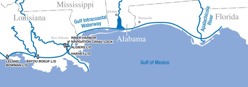
The eastern stretch of the GIWW begins at the lock into the Industrial Canal coming off the Mississippi River near New Orleans. It is preceded immediately by a bascule bridge with coordinated openings. If stopping in the Crescent City, your best bet is to seek a marina on the south shore of Lake Pontchartain. The waterway continues through the Rigolets channel and onward toward Gulfport, Miss.
The Army Corps of Engineers maintains the waterway with a controlling depth of 12 feet. The Corps has posted mile markers each starting with Mile 0 at the Mississippi River and increasing each statute mile until it ends at the St. Marks River in the Florida Panhandle. From the end, vessels must travel offshore until the Intracoastal Wateray picks up again in the Greek fishing town of Tarpon Springs, Fla.
Navigational markers run clockwise around the coast, so moving from New Orleans toward Florida, keep red markers on your port side and green to starboard. Confusion can occur where the GIWW intersects with other channels. You can distinguish which markers designate the GIWW by looking for a yellow square beneath the number on markers to be kept on your port side and yellow triangles beneath the number on markers to leave to your starboard side.
All bridges along the GIWW have 65 feet or greater vertical clearance.
While there is significant commercial barge traffic between the Mississippi and Mobile Bay, the stretch from Pensacola to the end of the GIWW is dominated by fishing and pleasure craft.